panorama photography
-
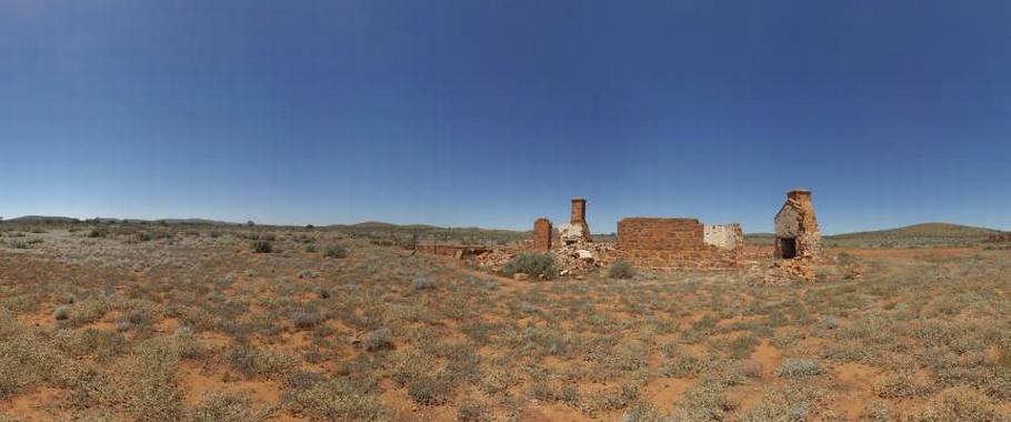
Grampians views and farm ruin at Great Western
Panoramic views of the Grampians ranges with the ruins of an old farm cottage at Great Western Victoria, Australia.
Great Western is a small highway town in the Wimmera region, 225 kilometres north-west of Melbourne. European settlement of the area started with the arrival of graziers in the region until the Victorian gold rush drew thousands of people to the area. Today, Great Western is known for its many vineyards and wineries.
-
Guido Van Helten mural in Brim
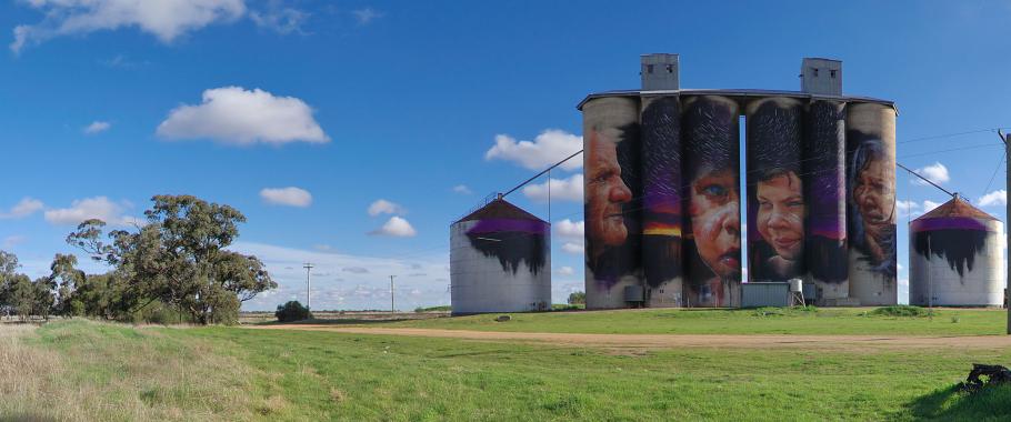
Panorama of large Guido Van Helten mural on grain silos in Brim in the Wimmera region of Victoria, Australia.
Artist Guido Van Helten painted the 30 metre high portraits of four farmers on disused grain silos over 3 weeks finishing early January 2016. Brim with a population of about 100 people is located 20 kilometres north of Warracknabeal or 360 kilometres northwest of Melbourne. The giant artwork was funded by Regional Arts Victoria and the Yarriambiack Shire Council.
-
Historic ghost town Silverton
Panoramic views over the former silver mining town in outback New South Wales, Australia. For a short time Silverton was a busy mining town after silver was found in 1875. By 1888 Silverton was connected to South Australia via a tramway.
While most buildings had been relocated after the decline of its mining industry, the remaining ghost town has been used for advertising commercials and films like Wake in Fright, Mad Max 2, Razorback, A Town Like Alice, The Craig, Dirty Deeds and many others.
Today the town has become a popular tourist attraction with several art galleries, museums, cafes and the famous Silverton hotel. Silverton is 24km north-west of Broken Hill or 1,180km west of Sydney.
-
Millewa A Steam Pumping Station
Panorama of the Millewa A Steam Pumping Station on the Murray River, Murray Sunset National Park, Victoria, Australia.
Millewa A Pumping Station is the last operational wood fired steam driven Victorian built pump on the Murray River. Situated at Lock 9 the pumping station can be reached via unsealed road from Lake Cullulleraine. The pumping station was constructed in 1927 and formed part of an irrigation system which supplied water to 462 soldier settler farms once a year. Water supply was limited to the winter months because 95% of the water evaporated in over 1,000 kilometres of open channels.
-
Moonrise and Sunset at One Tree
 Panorama of a rising Full Moon during Sunset at One Tree Hotel. The full moon always rises close to the time the sun sets and occasionally the full moon rises a few minutes before the sun sets.
This impressive scenario is best seen on flat terrain of which the outback of Australia has plenty to offer. This photo was taken in October 2014 at One Tree Hotel on the Cobb Highway north of Hay.
A 360 degree panorama is probably the best option to capture this moment when the full moon appears opposite the setting sun. The outback setting on the vast plains north of Hay is also free of light pollution to make this event a great experience.
-
Mount Cole Reservoir
Panorama of Mount Cole Reservoir.
Panorama of Mount Cole Reservoir in the Mount Buangor state Park, Victoria, Australia. Mount Buangor State Park is a native bush reserve between Beaufort and Ararat. The reservoir is a great location for bird watching or a picnic but is only accessible with vehicles with good ground clearance.
-
Panoramas
The panoramas on this website are categorized by Australian states.
Please select a state below to view the panoramas available for each state.
-
Panoramas-Australian-Capital-Territory
Spherical Panoramas covering the Australian Capital Territory
-
Panoramas-New-South-Wales
Spherical Panoramas covering the state of New South Wales in Australia
-
Panoramas-Northern-Territory
Spherical Panoramas covering the Northern Territory of Australia
Page 1 of 2
