Historic ghost town Silverton
- Details
- Written by: Klaus Mayer
- Category: Panoramas-New-South-Wales
- Hits: 12069
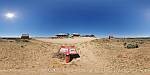
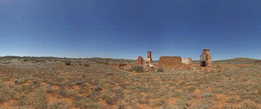
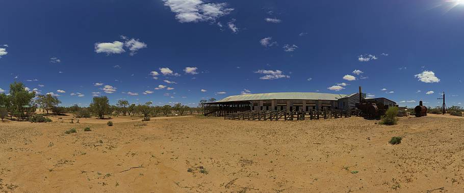
Panoramic views over the former silver mining town in outback New South Wales, Australia. For a short time Silverton was a busy mining town after silver was found in 1875. By 1888 Silverton was connected to South Australia via a tramway.
While most buildings had been relocated after the decline of its mining industry, the remaining ghost town has been used for advertising commercials and films like Wake in Fright, Mad Max 2, Razorback, A Town Like Alice, The Craig, Dirty Deeds and many others.
Today the town has become a popular tourist attraction with several art galleries, museums, cafes and the famous Silverton hotel. Silverton is 24km north-west of Broken Hill or 1,180km west of Sydney.
Moonrise and Sunset at One Tree
- Details
- Written by: Klaus Mayer
- Category: Panoramas-New-South-Wales
- Hits: 12154
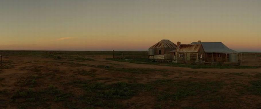
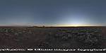 Panorama of a rising Full Moon during Sunset at One Tree Hotel. The full moon always rises close to the time the sun sets and occasionally the full moon rises a few minutes before the sun sets.
This impressive scenario is best seen on flat terrain of which the outback of Australia has plenty to offer. This photo was taken in October 2014 at One Tree Hotel on the Cobb Highway north of Hay.
A 360 degree panorama is probably the best option to capture this moment when the full moon appears opposite the setting sun. The outback setting on the vast plains north of Hay is also free of light pollution to make this event a great experience.
Brachina Gorge in Flinders Ranges National Park
- Details
- Written by: Klaus Mayer
- Category: Panoramas-South-Australia
- Hits: 11798
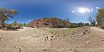
Panorama of Brachina Gorge in Flinders Ranges National Park, South Australia.
Brachina Gorge is one of the most spectacular and popular attractions in the Flinders Ranges National Park where a self guided geological trail passes through 130 million years of earth history.
Brachina Gorge is roughly 470 kilometres north of Adelaide and 200 kilometres northeast of Port Augusta. Brachina Gorge Road is unsealed but can be suitable for 2WD when conditions are good. The Flinders Ranges NP is one of the most scenic National Parks in Australia and offers a range of accommodation at Wilpena or Hawker.
Prior to European settlement in the mid 1800s aborigines had lived in the ranges for tens of thousands of years leaving behind rock paintings, rock engravings and many artifacts. The climate is semi arid with hot dry summers and cool winters, the average rainfall is very low with 250mm per annum.
Homestead Creek in Mutawintji National Park
- Details
- Written by: Klaus Mayer
- Category: Panoramas-New-South-Wales
- Hits: 9527
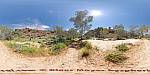
Panorama of Homestead Creek in the Mutawintji National Park, New South Wales, Australia.
This scenic outback park with colourful Bynguano Ranges is located between White Cliffs and Broken Hill. The rugged desert region had been continuously used by Aboriginals for thousands of years before European settlement. After a long struggle by the traditional owners the area was returned to them in 1998. The park is now held by the Mutawintji Local Aboriginal Land Council and a Board of Management oversees the operation of the park.
Page 4 of 7