360 degree panorama
-
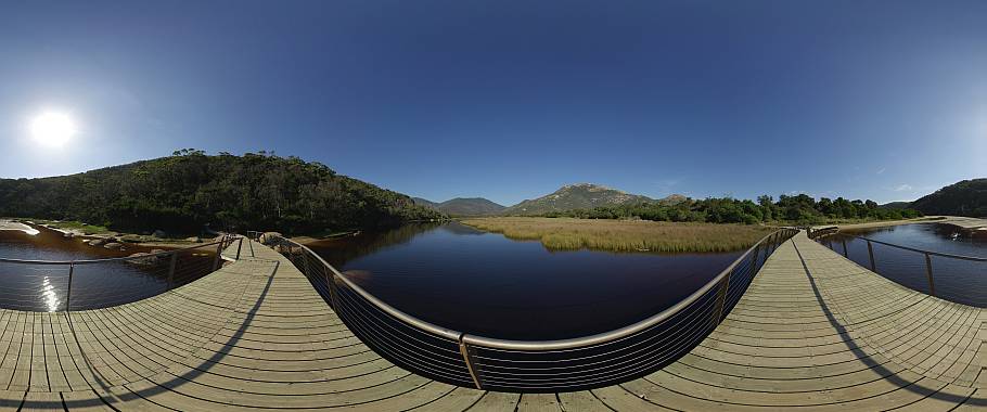
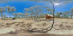
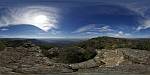
Boat shed at Dove Lake with Cradle Mountain
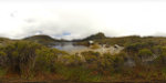
Boat shed at Dove Lake in Cradle Mt - Lake St Clair National Park.
The view across Dove Lake to the jagged dolerite peak of Cradle Mountain is considered as one of Tasmania's natural highlights. Cradle Mountain forms the northern end of Cradle Mountain - Lake Saint Cliair National Park in Tasmania's north. The NP is part of the Tasmanian Wilderness World Heritage Area which protects the remaining ancient rain forests, alpine heath lands and deciduous beech forests.
-
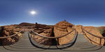
Brachina Gorge in Flinders Ranges National Park
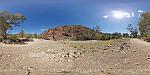
Panorama of Brachina Gorge in Flinders Ranges National Park, South Australia.
Brachina Gorge is one of the most spectacular and popular attractions in the Flinders Ranges National Park where a self guided geological trail passes through 130 million years of earth history.
Brachina Gorge is roughly 470 kilometres north of Adelaide and 200 kilometres northeast of Port Augusta. Brachina Gorge Road is unsealed but can be suitable for 2WD when conditions are good. The Flinders Ranges NP is one of the most scenic National Parks in Australia and offers a range of accommodation at Wilpena or Hawker.
Prior to European settlement in the mid 1800s aborigines had lived in the ranges for tens of thousands of years leaving behind rock paintings, rock engravings and many artifacts. The climate is semi arid with hot dry summers and cool winters, the average rainfall is very low with 250mm per annum.
-
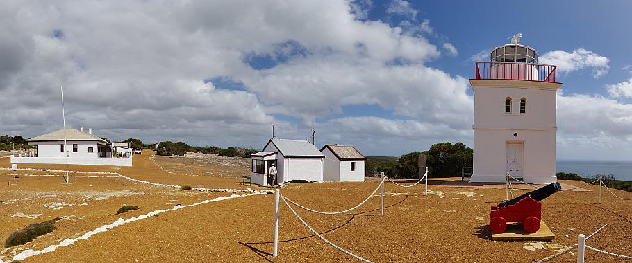
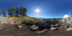
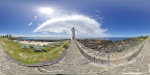
Cape Borda Lighthouse
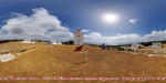
Panoramic views from Cape Borda Lighthouse.
The Cape Borda lighthouse is the shortest (10 metres high) and highest (155 metres above sea level) lighthouse in Australia. Located on the remote north-west corner of Kangaroo Island, the lighthouse has been in operation since 1858. Cape Borda lighthouse is the 3rd oldest lighthouse and only square shaped lighthouse in South Australia. The small canon was originally put in place to be fired during fog to signal ships of danger but since its restoration in 1999 the cannon is fired daily at 1pm. The headland is named after the French mathematician, physicist, naturalist, and sailor Jean-Charles de Borda.
-
Cape Willoughby Lighthouse
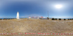
Panorama of Cape Willoughby Lighthouse and Backstairs Passage on Kangaroo Island.
Cape Willoughby was the first lighthouse in South Australia erected in 1852 and stands on the southern shores of the narrow Backstairs Passage between Kangaroo Island and mainland Australia. The lighthouse is 20.5 metres high and stands 75 metres above sea level on the eastern extremity of the island.
-
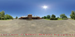
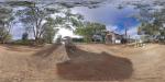
Disused church in Glenorchy
Panorama of bushland and the disused Catholic Church in Glenorchy, Victoria, Australia.
In 1847 a hotel and store opened at the crossing place of the Wimmera River after which the small township developed. The former Roman Catholic Church from 1914 was built in Federation Gothic style. Although the building is considered to be of architectural, historical and social significance at local level, it has deteriorated to a a fairly poor condition.
-
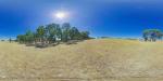
Emu Bay
Panorama of Emu Bay on Kangaroo Island.
Emu Bay is a scenic shallow bay in the north of Kangaroo Island approximately 13 kilometres north-west of Kingscote.
-
Franklin Wharf, Hobart
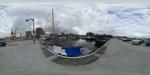 Panorama of ships mooring at Franklin Wharf.
Franklin Wharf at Hobart's waterside has many good places for seafood ranging from fish and chips to stylish restaurants.
-
Frenchmans Rock
Panorama of Hog Bay and Frenchman's Rock in Penneshaw, Kangaroo Island, South Australia.
The location received its name due to a rock on which a crew member of french explorer Nicolas Baudin carved the arrival of the expedition. The original rock was moved to the visitor information centre and a replica is now in place to commemorate this historic event.
-
Glider at Mount William, Victoria
Grampians panorama with a glider passing Mount William.
Strong westerly winds between May and October cause at times a phenomenon known in the glider community as Grampians Wave. The Grampians Wave can enable gliders to reach altitudes of over 8,500 metres.
-
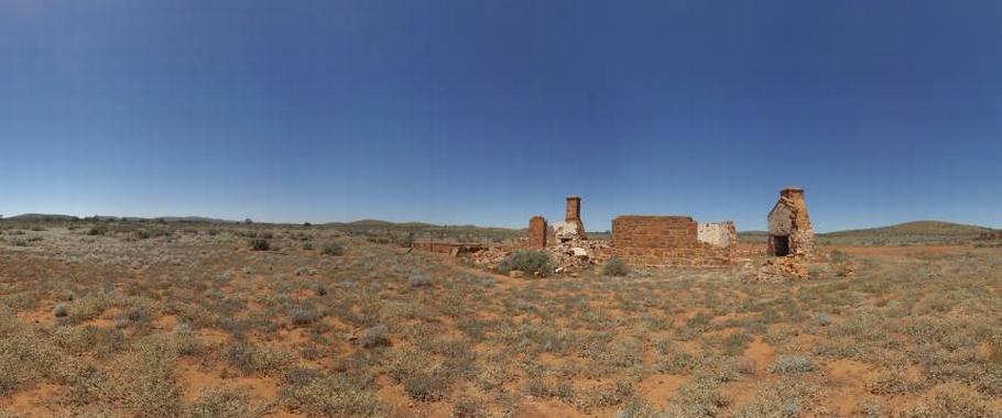
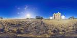
Grampians views and farm ruin at Great Western
Panoramic views of the Grampians ranges with the ruins of an old farm cottage at Great Western Victoria, Australia.
Great Western is a small highway town in the Wimmera region, 225 kilometres north-west of Melbourne. European settlement of the area started with the arrival of graziers in the region until the Victorian gold rush drew thousands of people to the area. Today, Great Western is known for its many vineyards and wineries.
-
Griffiths Island Lighthouse, Port Fairy
Panorama of Griffiths Island Lighthouse at historic Port Fairy on the Moyne River in Victoria.
The lighthouse made of bluestone was built in 1859 at the mouth of Moyne River on the eastern tip of an island which was then known as Rabbit Island.
-
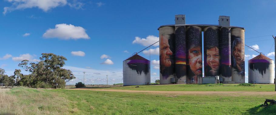
Guido Van Helten mural in Brim
Panorama of large Guido Van Helten mural on grain silos in Brim in the Wimmera region of Victoria, Australia.
Artist Guido Van Helten painted the 30 metre high portraits of four farmers on disused grain silos over 3 weeks finishing early January 2016. Brim with a population of about 100 people is located 20 kilometres north of Warracknabeal or 360 kilometres northwest of Melbourne. The giant artwork was funded by Regional Arts Victoria and the Yarriambiack Shire Council.
-
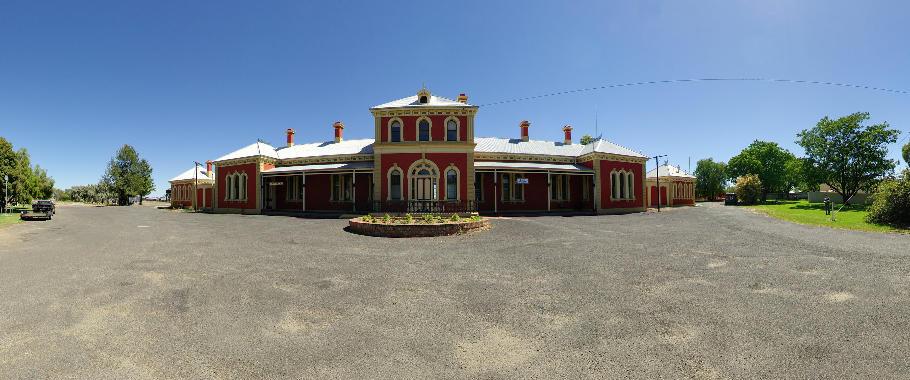
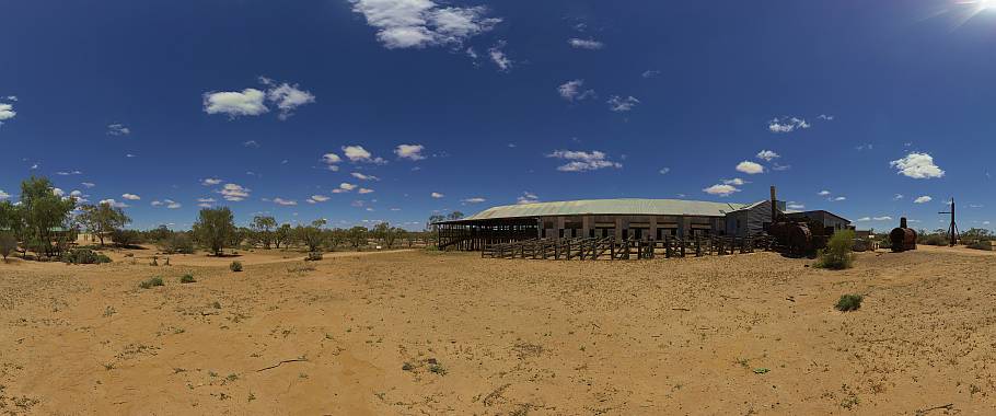
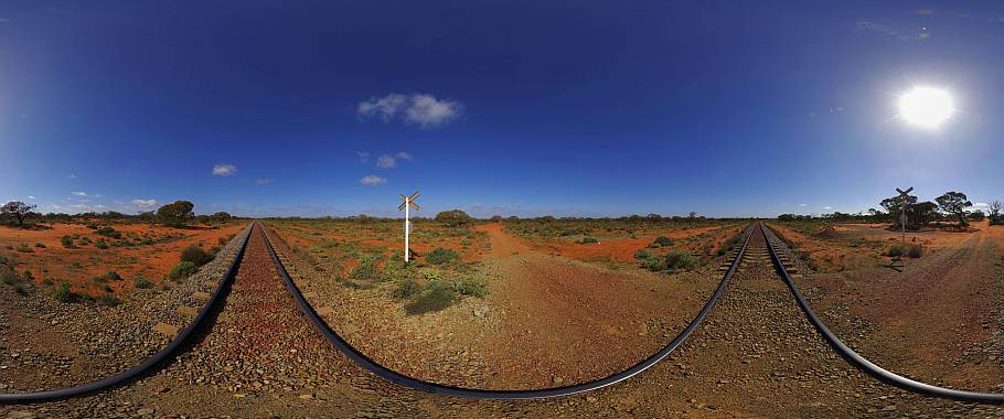
Hay Railway Station
Panorama of Hay Railway Station.
The historic Railway Station has been beautifully maintained although the last train left in 1983. The building from 1882 is now home to a local radio station. 2 old carriages on the platform house a museum for the internment camps in Hay during WWII which held German and Austrian internees (the Dunera Boys) who arrived from England on the HMT Dunera in 1940.
-
Herbig Tree in Springton
Panorama of the Herbig family tree in Springton, Adelaide Hills, South Australia.
Johann Friedrich Herbig arrived in South Australia from Bremen, Germany, in 1855. Herbig, the first German to settle here, made is home in this old hollow red gum tree at Black Springs as this area was then known. The tree, over 6 metres wide at its base and over 23 metres high, became his dwelling for 5 years. In 1858 Herbig married 18 year old Anna Caroline Rattey, also a Lutheran refugee from Germany, and both continued to live in the tree until a pine and pug dwelling was constructed after the birth of their second son.
Herbig arrived almost penniless in South Australia but by his death the family assets had grown to nearly 1,000 acres of land. Herbig and his wife had 9 boys and 7 girls. Herbig died at the age of 58 from brain damage after falling from a load of chaff.
-
Historic ghost town Silverton
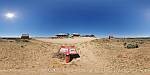
Panoramic views over the former silver mining town in outback New South Wales, Australia. For a short time Silverton was a busy mining town after silver was found in 1875. By 1888 Silverton was connected to South Australia via a tramway.
While most buildings had been relocated after the decline of its mining industry, the remaining ghost town has been used for advertising commercials and films like Wake in Fright, Mad Max 2, Razorback, A Town Like Alice, The Craig, Dirty Deeds and many others.
Today the town has become a popular tourist attraction with several art galleries, museums, cafes and the famous Silverton hotel. Silverton is 24km north-west of Broken Hill or 1,180km west of Sydney.
-
Homestead Creek in Mutawintji National Park
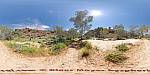
Panorama of Homestead Creek in the Mutawintji National Park, New South Wales, Australia.
This scenic outback park with colourful Bynguano Ranges is located between White Cliffs and Broken Hill. The rugged desert region had been continuously used by Aboriginals for thousands of years before European settlement. After a long struggle by the traditional owners the area was returned to them in 1998. The park is now held by the Mutawintji Local Aboriginal Land Council and a Board of Management oversees the operation of the park.
-
Island Beach on KI
Panorama of Island Beach on Kangaroo Island.
Island Beach is a 4 kilometre long swimming beach in Eastern Cove approximately 16 kilometres south-west of Penneshaw.
-
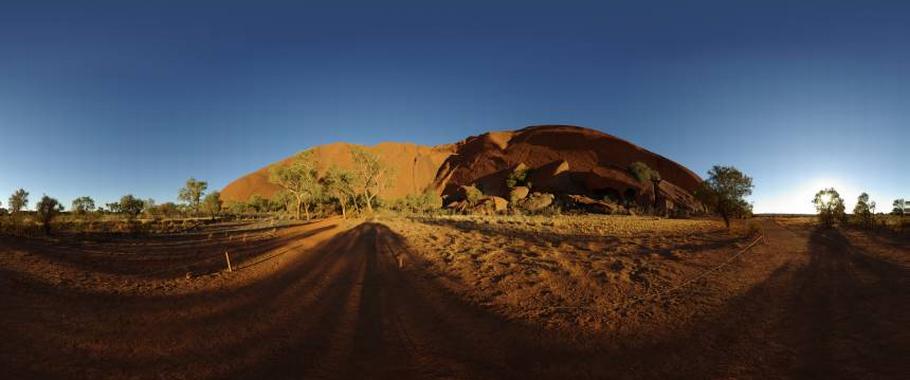
Kings Canyon, Watarrka National Park
Panorama of Kings Canyon.
Watarrka National Park is located approximately 330kms southwest of Alice Springs. The Park comprises a total area of 722 sq km and encompasses the western end of the George Gill Range. The main natural features of the park are the rugged ranges, sandstone domes and outcrops, narrow gorges and rock holes.
-
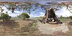
Millewa A Steam Pumping Station
Panorama of the Millewa A Steam Pumping Station on the Murray River, Murray Sunset National Park, Victoria, Australia.
Millewa A Pumping Station is the last operational wood fired steam driven Victorian built pump on the Murray River. Situated at Lock 9 the pumping station can be reached via unsealed road from Lake Cullulleraine. The pumping station was constructed in 1927 and formed part of an irrigation system which supplied water to 462 soldier settler farms once a year. Water supply was limited to the winter months because 95% of the water evaporated in over 1,000 kilometres of open channels.
-
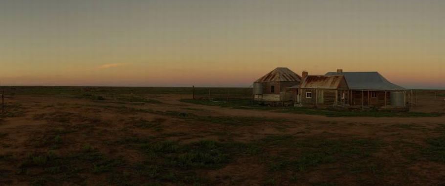
Moonrise and Sunset at One Tree
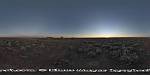 Panorama of a rising Full Moon during Sunset at One Tree Hotel. The full moon always rises close to the time the sun sets and occasionally the full moon rises a few minutes before the sun sets.
This impressive scenario is best seen on flat terrain of which the outback of Australia has plenty to offer. This photo was taken in October 2014 at One Tree Hotel on the Cobb Highway north of Hay.
A 360 degree panorama is probably the best option to capture this moment when the full moon appears opposite the setting sun. The outback setting on the vast plains north of Hay is also free of light pollution to make this event a great experience.